
AirIPR system: Airborne Ice-Penetrating Radar
Background
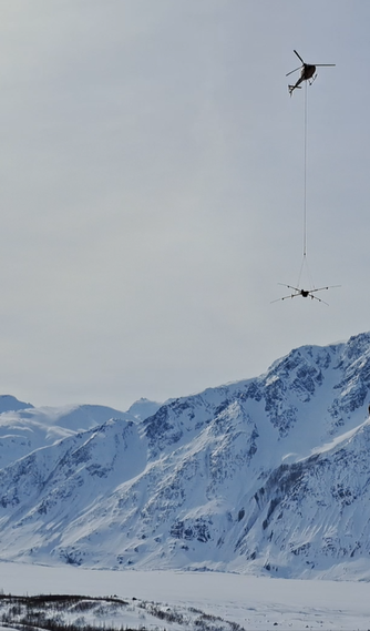
Helicopter-based radar surveys fill the gap between two well established radar techniques. First, larger scale airplane-based surveys, which often lack tight maneuverability, and thus often restrained to longitudinal glacier transects (incurring valley walls data issues, off-nadir bed reflections). Second, ground-based surveys on foot, skis, and snow machines, that are inherently slow and constrained by terrain and surface conditions. Considering that all these techniques should be seen as complementary, we believe that helicopter-based surveys can address these challenges, insomuch that excellent flying conditions (visibility, wind) are met.
Image Credit: Kim Flament
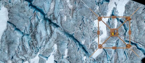
In this context, AirIPR is a new, field-proven, airborne ice-penetrating radar system for targeted, precise, helicopter-based glacier surveys to obtain ice depth as well as englacial properties.
Image Credit: Kim Flament
In this context, AirIPR is a new, field-proven, airborne ice-penetrating radar system for targeted, precise, helicopter-based glacier surveys to obtain ice depth as well as englacial properties.
System - Standard AirIPR
|
Based on the roving & stationary IceRadar IPR (and sIPR) implementations [1], [2] , the standard AirIPR system comes with an enhanced onboard software for airborne operation, integrating radar data with additional hardware data source(s) such as the AGL system that provides above-ground elevation measurements. The AGL, also plays a critical role in providing elevation information to the helicopter pilot, with a dedicated wireless display located in the cockpit.
|
Operation
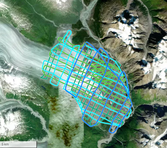
Data Example
Tweedsmuir Glacier, Tatshenshini-Alsek Provincial Park, BC, Canada, Traditional territory of The Champagne and Aishihik First Nations.
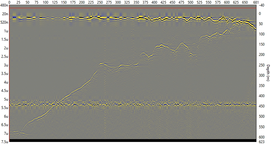
Processing to enhance bed at ~ 600m
Processing to enhance bed at ~ 600m
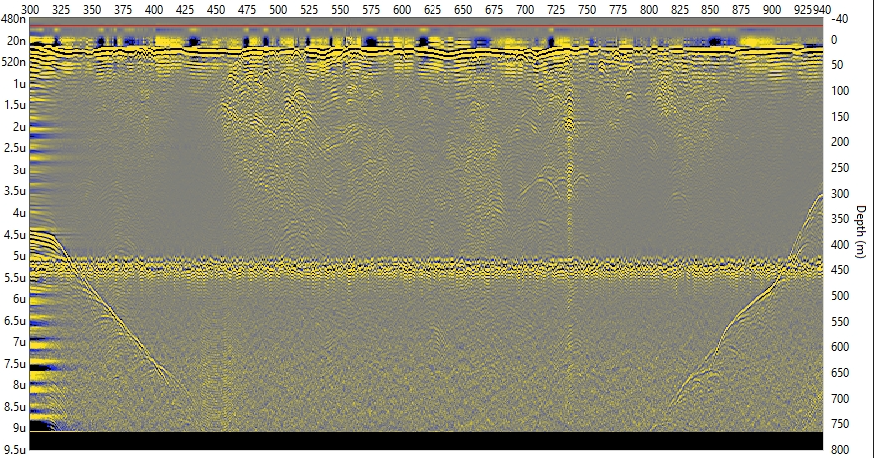
Grand Pacific Gl. Tatshenshini-Alsek Provincial Park, BC, Canada. Traditional territory of The Champagne and Aishihik First Nations.
Processing to enhance bed at ~ 600m
Processing to enhance bed at ~ 600m
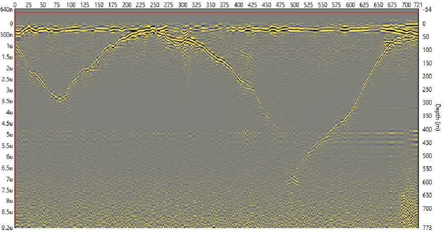
Kaskawulsh Gl., Kluane National Park, Yukon, Canada. Traditional terrirory of Kluane First Nation.
Disappearing bed around 700-750m with experimental Tx
Disappearing bed around 700-750m with experimental Tx
References
- [1]: Mingo, L., & Flowers, G. (2010). An integrated lightweight ice-penetrating radar system. Journal of Glaciology, 56(198), 709-714.
- [2]: Bigelow, D. G., Flowers, G. E., Schoof, C. G., Mingo, L. D. B., Young, E. M., & Connal, B. G. (2020). The role of englacial hydrology in the filling and drainage of an ice-dammed lake, Kaskawulsh Glacier, Yukon, Canada. Journal of Geophysical Research: Earth Surface, 125, e2019JF005110.
- [3]: Main, B., Copland, L., Smeda, B., Kochtitzky, W., Samsonov, S., Dudley, J., . . . Mingo, L. (2022). Terminus change of Kaskawulsh Glacier, Yukon, under a warming climate: Retreat, thinning, slowdown and modified proglacial lake geometry. Journal of Glaciology, 1-17.