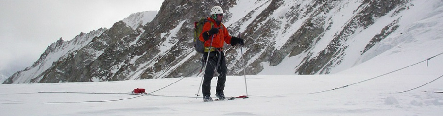
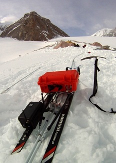
IceRadar System - Roving
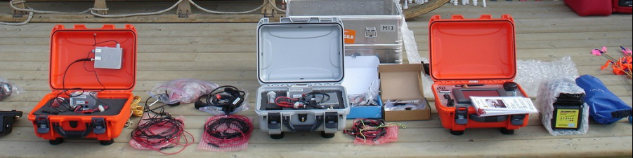
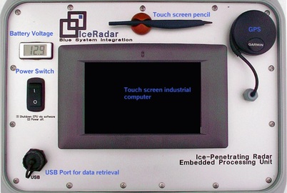
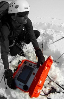
The IceRadar Turn-Key System is field-ready and comprises a radar receiving unit, one antenna set ( choice of a single center frequency from 3MHz to 70 MHz), rigging components and binding system to ski-based sled system, ski-based sled system, collapsible antenna protection tubing, strain-reliefs. Radar signal inputs ports are located on the back of enclosure. Connectivity components between antennas and unit are included. The EPU (Embedded Processing Unit) is equipped with the acquisition electronics, one IceRadar license, GPS and touch-screen embedded computer. Both radar and GPS data are acquired and logged continuously (user selectable) and radar data are displayed live as 1D and 2D radargrams while in motion.
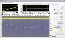
The IceRadarAnalyzer software is also included, for quick data viewing, analysis, fast picking, and data export. The hdf5 files that are produced by the radar system can also be accessed by third-party programing languages such as, but not limited to, Matlab and Python. All components, such as voltage monitoring display, switch, and data port are splash and dust proof. Once shut, the rugged enclosure remains sealed against water and dust.
The IceRadarAnalyzer software is also included, for quick data viewing, analysis, fast picking, and data export. The hdf5 files that are produced by the radar system can also be accessed by third-party programing languages such as, but not limited to, Matlab and Python. All components, such as voltage monitoring display, switch, and data port are splash and dust proof. Once shut, the rugged enclosure remains sealed against water and dust.
Ruggedized, Portable Embedded Processing Unit (EPU) to Acquire, Display, and Manage Radar Data
Advanced Software Features
|
IceRadar and World Glaciers, as of 2013
|
- 8-16 bit selectable resolution based on sampling rate settings from 62.5MS/s (16-bit) (*) 125MS/s(up to 15 bits), 500 MS/s (up to 12 bits) ,
- 200 MHz Bandwidth (**)
- user-enable 20 MHz low pass filter (*)
- External GNSS
- Faster transfer rate enabling more stacking (setting up to 32,000 stacks for slow survey. Note: this is also transmitter’s PRF dependent)
- 8” touch screen
- dual-core 2GHz cpu
- 60-64 GB flash disk
- drop-in replacement including antenna connections and sled anchors with original system.
Software
|
|